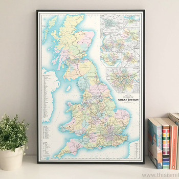
This unique map of the present-day railway network in Great Britain is an original, digitally-rendered design that takes its inspiration from vintage maps.
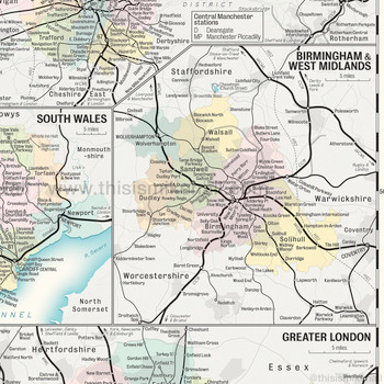
Designed in a retro mid-20th century style, it shows the majority of intercity, regional and commuter lines, heritage railways, the locations of most stations and high-speed lines under construction (as of June 2022). It also includes enlargements of major conurbations including Edinburgh, Glasgow, Greater London, Greater Manchester, Merseyside, the West Midlands and West Yorkshire.
Each type of railway is represented by a variety of stroke widths and styles, graduating from the thickest (high speed lines) to the thinnest (local commuter and heritage railway lines), while stations are marked by dots and circles; larger circles represent important interchanges. Major roads and ferry routes are also shown.
Please note that some lines and stations have been deliberately omitted due to space constraints, and metro systems of individual cities are also not shown.
The design is finished with a simple, elegant border and title box with a scale bar.
High quality digital giclée print on 230gsm archival paper in A1. Signed in pencil by the artist, with a stamp of authenticity on the rear.
Sold unframed.


